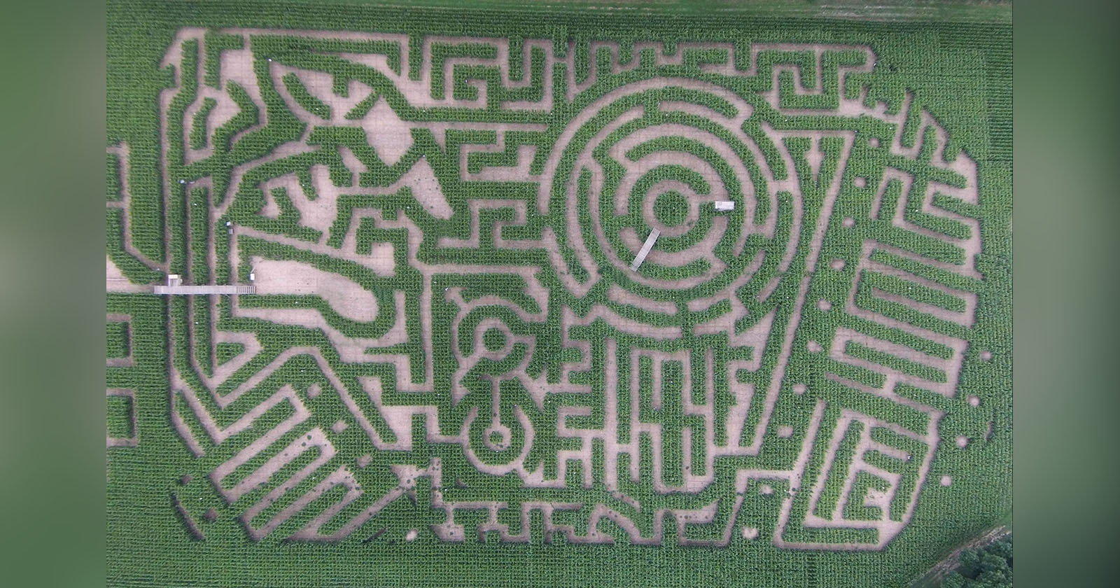
Satellite Photographs Being Used to Cheat at Corn Mazes

This has got to be one of the saddest uses of imagery ever. The Daily Mail is reporting that iPhone owners in the UK are using satellite photos and GPS to cheat at getting out of corn mazes. By seeing their current location in a birds-eye view of the maze, visitors can quickly solve even the most challenging corn mazes.
Adventure seekers usually spend anything up to 90 minutes getting lost in the Hedge Maze at Longleat Safari Park, Wiltshire, before finding the exit.
But staff at the attraction have noticed people are working their way round the labyrinth of two miles of pathways and 16,000 yew trees in just a matter of minutes.
The idea is clever, but super lame. Can you think of anything else that satellite imagery can help you cheat at?
Image credit: Cheating in the maze by Andrew*